Brother Aaron and I left Salt Lake on our bikes on June 5 and returned to Salt Lake late June 14, 2014. Between that time we rode about 80 hours, 875 miles and 60,000 vertical feet through Utah's desert and mountains. It was exactly the adventure I was hoping for.
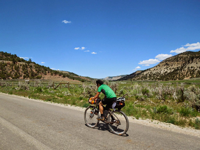
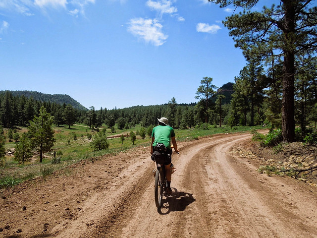
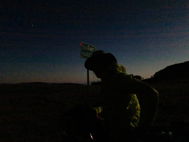
Day 1: We left SLC, climbed up Big Cottonwood Canyon to Guardsman Pass, descended to Midway and Heber, and then climbed up into the Uinta National Forest. We were surprised and slightly disappointed to log only 62 miles for the day. But climbing 10,500 feet with 50 pound bikes is a worthy challenge. As the sun set, we were happy to find a campsite in an idyllic setting.
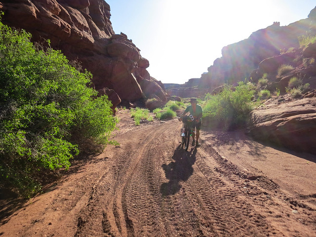
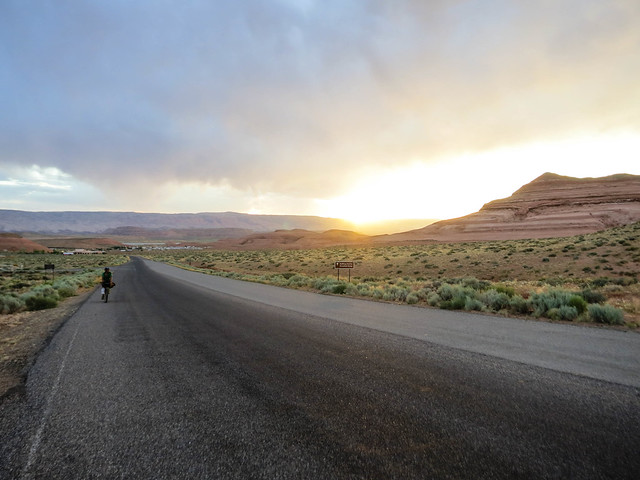
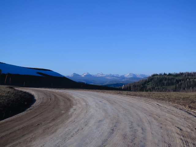 |
| Somewhere between Heber and Wolf Creek Pass with High Uintas in view. Day 1. |
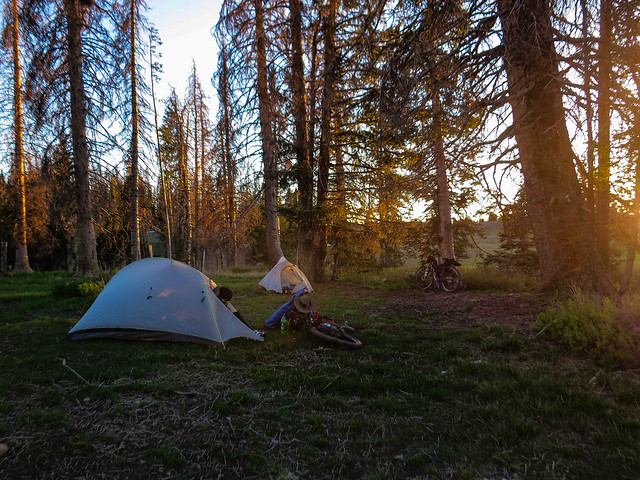 |
| Camp 1 in the Uinta National Forest |
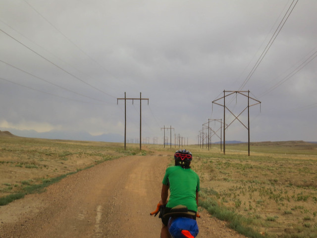
Day 2: We awoke early, anxious to get to Wolf Creek Pass. On Duchesne Ridge, we were met with snow. Much of the time, we were able to ride our rigs across the frozen snow. Sometimes though we were met with muck and slush. We connected to pavement at Wolf Creek Pass and descended through Hanna and Tabiona, and then rode to Duchesne. From Duchesne, our GPS route led us into an alfalfa field. After we got that straightened out, we pushed out of Myton into a brutal headwind, riding through the Uinta Basin and the thumping of oil/gas wells. A few minutes before all the light of the day was gone, we turned off the road and set up camp. On a scale of 1-10 with 10 being "I wish I had a flame thrower," swarming gnats were a solid 9. We threw up our tents and dived inside for cover. 101 miles, 4044 vertical, and 14 hour day.
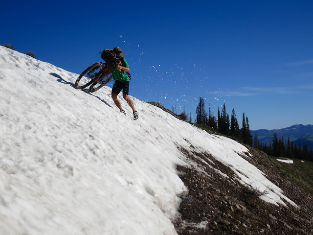 |
| Aaron fighting his bike and the "Pig" (his drybag strapped onto his rack) on Duchesne Ridge |
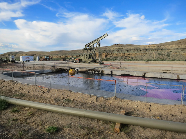 |
| Oil Wells in the Uinta Basin |
Day 3: The gnats nibbled at us throughout the day. We climbed Gate Canyon and entered Nine Mile Canyon. We were short on water and happy to reach Nine Mile Ranch where we filled our bottles, dunked our heads, and hand-washed our jerseys. "Water's free," the campground host said, but we handed him $4. Soon we had climbed out of Nine Mile Canyon and had a downhill and relatively fast 15 mile cruise into Wellington where we rode the highway (including a 1 mile stretch of I-70) to Green River. The tailwind from Wellington to I-70 junction was killer. 112 miles, 4123 vertical gain, 13 hrs.
 |
| Nine Mile Canyon was dotted with mostly-abandoned ranches. |
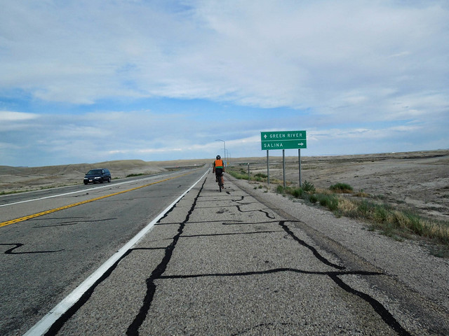 |
| I found an orange safety vest on the side of the road near Duchesne. I was glad to have found it and wore it religiously when our route went on the pavement. About to merge onto I-70. |
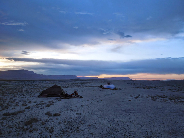 |
| Day 3: We pitched our tents in the cracked desert outside of Green River. We awoke to threatening clouds and barely got our gear packed before a short but strong dust storm. |
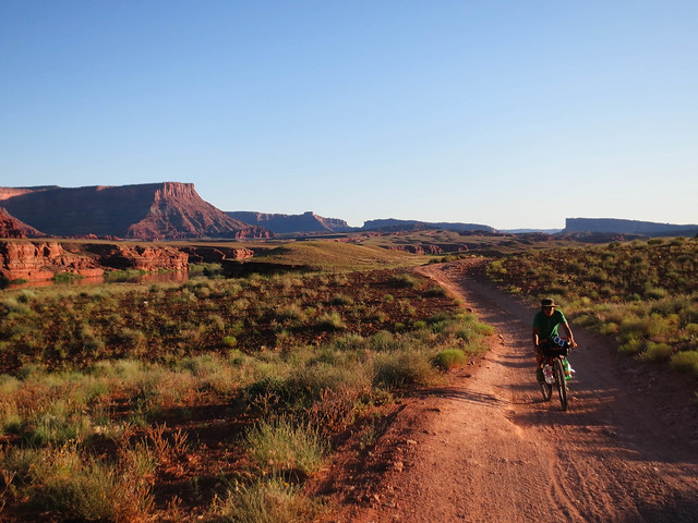
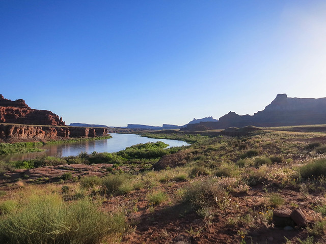
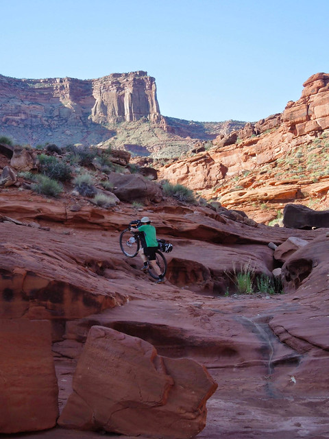
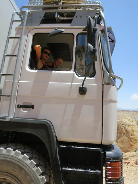
Day 4: We arrived in Moab via mostly backroads before lunch. I was feeling pretty thrashed. Eating at a chinese buffet, showering and laundering my one set of riding clothing (while showering) in the Moab rec center, and then taking a nap helped. We ate an early dinner and then pedaled west toward Hurrah Pass. We climbed Hurrah Pass as the sun was setting and descended toward the Colorado River to find a place to camp. 70 miles, 3780 vertical gain.
 |
| Good morning Green River! |
 |
| If we are riding on rubber under power lines during an electrical storm . . . ? Outside of Moab. |
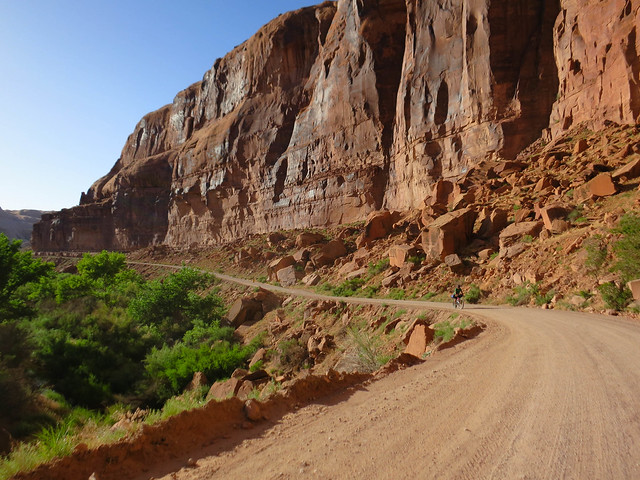 |
| Kane Creek road leading to Hurrah Pass. |
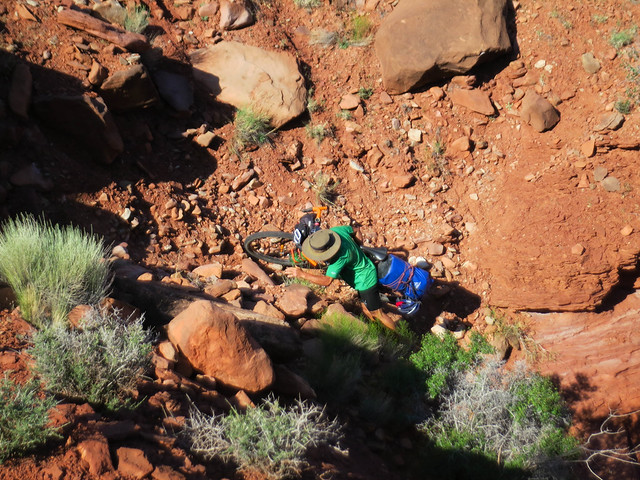
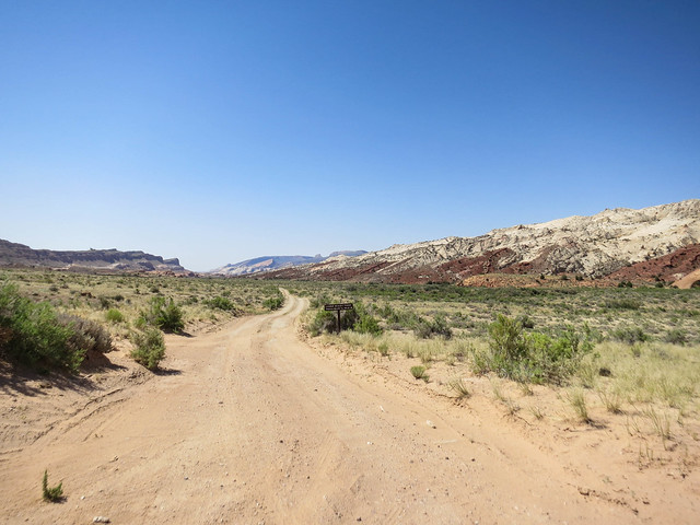
Day 5: We rode the Lockhart Basin road. I'd been on the lower portion several times, but the upper portion was surprising in that it was rougher, harder to follow, more ups and downs, and more technical. We spent 1.5 hrs being lost after trying to follow our GPS route. Mapping software is not always up to date. Don't trust it. Getting back on route required some serious bike packing up what was essentially a small cliff. After we got on track, we were able to steadily tick miles off. It got hot and we slowly drained our water stores. I knocked my Jetboil over and spilled boiling water on my thigh. At the end of the Lockhart road, we put up tents in the shade of Hamburger Rock and took a much needed siesta. We rode to Indian Creek (Gnats were a 9.5) and a researcher/rancher was kind enough to let us fill our water bottles at her ranch. 58 miles, 5305 vertical gain. Hard and hot day.
 |
| Early morning light on Lockhart Basin road. We got an early start, hoping to avoid the heat of the day. |
 |
| At one point, the road almost touches the Colorado River. |
 |
| The GPS said we were on track, ATVs had followed this track, but it didn't seem like the right track. Aaron pushing through sand. |
 |
| Things got ugly. |
 |
| And then dire. I'm a cyclist, not a power lifter, or a cross-fitter. |
 |
| Indian Creek |
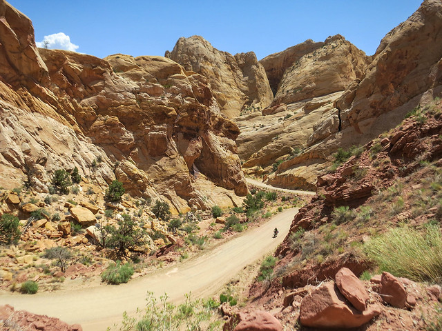
Day 6: Our campsite last night was one of the better ones, surrounded by high red cliffs and under a large juniper tree. I used precious water to take a towel bath last night, but since we are heading into the mountains, I am confident water will be available. We start down the Beef Basin road, and then turn towards Cottonwood Creek and find a NFS road that will take us to Elk Ridge over the south Manti-Lasal Mountains. We pass up a good water source at the base of the climb, but after we top out are worried that we won't find water. Should we just go to Blanding? On the plateau however, we find a small spring. On the descent, I crash quite heavily and skin up my left arm and side, particularly my leg. Aaron drips precious water over my wounds with his leaky bottle, which had fallen off his bike and been punctured. I put bandages where skin had been scraped off and we continue through the Ute reservation. Eventually, after a somewhat circuitous route and deciding that our depleted water stores and dwindling light require us to stop puttering around on dirt roads, we exit onto a paved highway 15 miles outside Blanding. Thinking Lake Powell is only 45 miles away, we turn away from Blanding, hoping to make it to Lake Powell on our last water stores. Before it gets dark, we eat a meal. Without enough water to camp, we pedal through the dark. After riding 20 miles, Lake Powell is more than 45 miles away. We see that Natural Bridges National Monument, and more importantly a visitor center with running water, is a 4 mile detour. We veer off the road into the sage brush, put up our tents, and try to sleep. Earlier that day, a mini-tornado blew over me, caking my sweaty self with a layer of grit and sand. Sleeping dirty is uncomfortable. Counting on getting water at the visitors center, I drain my bottle. 78.5 miles, 7,954 vertical gain, and 14:15 hrs.
 |
| Me, riding over the top of the Manti Lasal range, onto the Elk Ridge Road. |
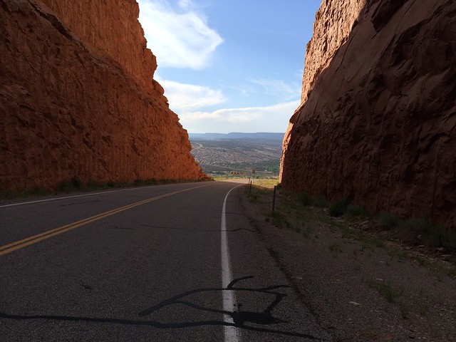 |
| This road cuts through a massive formation between Blanding and Hanksville. |
 |
| It's been a long day. More pedaling to come though. |
Day 7: We find water at the visitor center. I'm able to take a towel bath in the bathroom. After a couple days in the desert, running water is a luxury. We ride another 15 miles, and finally, Lake Powell is 45 miles away. Food-wise, I have a handful of beef jerky, 2 Gus, 4 Hi-Chews, and a drink mix left. I roll in to Halls Crossing, Lake Powell with a drink mix. We get a ride across the bay to Bullfrog, take a shower, stock up on some convenience store food, and eat at a restaurant. Riding through the desert between Moab and Lake Powell I had fantasies of diving into the lake. But once we got there, the winds were high and the water was brown. Still, it was nice to get there. That evening, we started up the Burr Trail. 69.6 miles, 2,548 vertical feet gained, 12:30 hrs.
 |
| Having a destination was motivating and, at times, daunting. |
 |
| Aaron pedaling out of Bullfrog Bay. |
Day 8: We rode the Burr Trail to Boulder. Due to a throbbing Achilles, I pedal long stretches barefoot. On the Burr Trail, we are given water by a French family who is driving around the world. We fuel up in Boulder and under a full moon climb the Boulder Mountain to the top of the Aquarius Plateau. 79.1 miles, 9,742 ft gained, and 12:30 hrs.
 |
| The heel on my Pearl Izumi shoe rode too high and irritated my Achilles. After a couple days of pedaling without a sock (to make more room in my shoe) and at times on top of my shoe, I cut out the heel part of my shoe, which helped. |
 |
| The waterpocket fold in Capitol Reef National Park. |
 |
| Aaron climbing up the Burr Trail switchbacks. |
 |
| This nice French lady asked if I needed water. Never turn down water in the desert. |
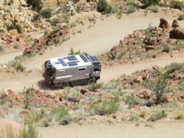 |
| What a cool expedition vehicle -- a customized MAN (the brand). |
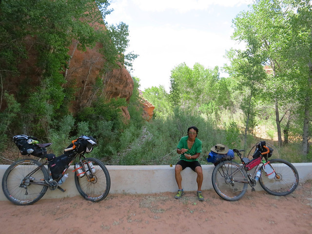 |
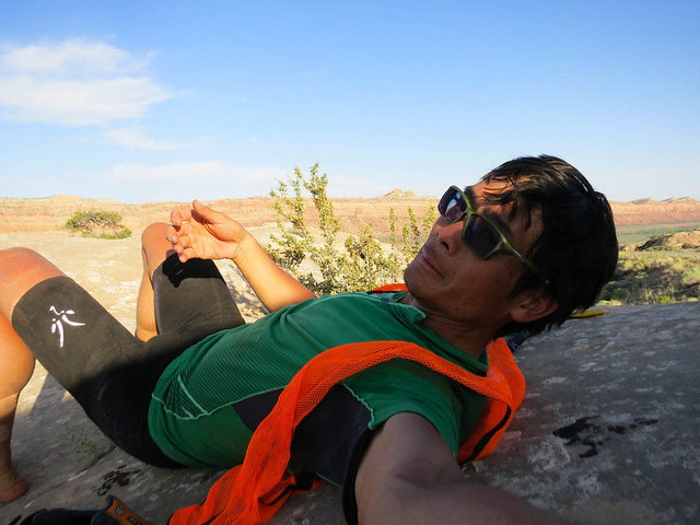
| Aaron and I took a much needed rest in the shade of towering cliffs and cottonwoods. Here, we shared a kipper snack. I drank some of the oil in the can. Kippers felt nourishing and didn't taste all that bad. |
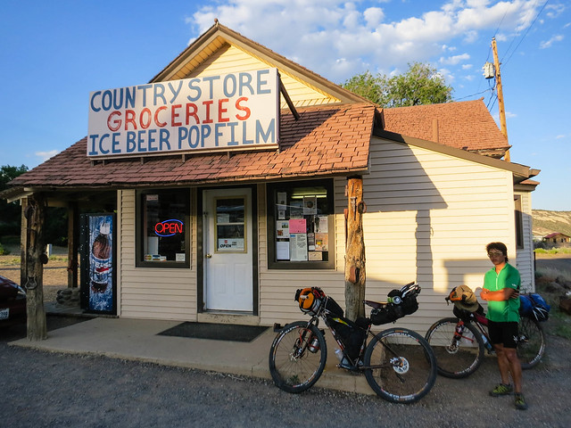 |
| Stocking up at a the "Country Store" in Boulder, Utah. |
 |
| At the summit of the Aquarius Plateau at about 10:30 at night. Riding at night under a full moon was energizing. |
Day 9: It was now Friday. We were on the Boulder Mountain. I wanted to avoid being absent from home on Sunday, Father's Day. There was still snow on the Skyline Drive. Our bodies were tired, scraped, and bitten. We needed at least 3-4 days to connect the Skyline Drive with the Wasatch mountains. Aaron and I elected to forego our route through the mountains and to make a 105 mile push on the pavement to Gunnison, where we grew up and where our parents have a home. We are battered by a brutal headwind for the first 60 miles. At about 5:00 pm, the winds favor us, and we ride the last 45 miles in under two hours. We make a steak dinner and are happy to sleep in real beds. 105 miles, 6,400 vertical gain.
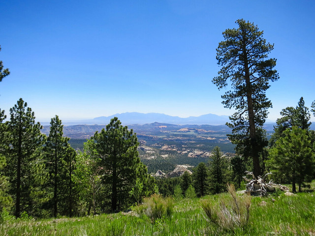 |
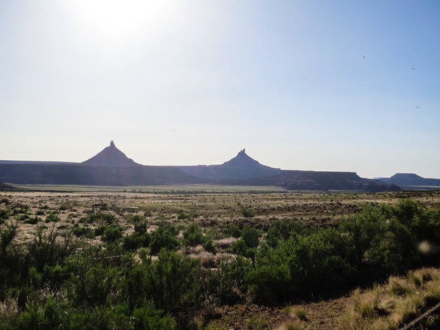
| View from the top of the Boulder Mountain, looking down towards the Burr Trail, the Henry Mountains, and Lake Powell. Riding through the Henry Mountains sounds interesting. |
Day 10: Our final day, we hope. A 135 mile push from Gunnison, Utah to Salt Lake. Again, on pavement. All day, it feels unusually cool. Is it unusually cool or have we acclimated to the desert heat? Massive, diminishing, brutal headwinds, again. Access to running water and convenience stores is nice. I stop for a Coke in Levan. I stop for a Coke in Nephi. I stop for a Coke in Payson. I stop for a Coke in Provo. It's 10:00 pm now and finally, in the shelter of the city, the headwinds have dissipated. Aaron and I crank our bikes down 1300 East at 20 miles per hour. Soon, I am home. 135 miles, 1,200 vertical gain.